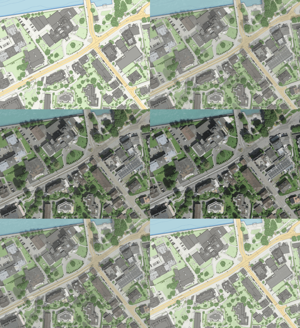
From David Oesch comes an enticing experiment1: AI-driven topographic map generation, inspired by an earlier experiment by Christian Hüttich.
The process as explained by David involves using an LLM2 to translate JSON-based webmap style specifications into a prompt for an LMM3. Feed the prompt (that e.g. specifies color values, line widths, line casing widths, etc.) and an aerial image into a suitable LMM4 and wait.
David’s result:
Clever workflow! And impressive5, low-effort results. I’m not sure if consistency and scalability6 is truly given, though?
Footnotes
From me comes the somewhat subversive “vibe cartography”.↩︎
Large language model↩︎
Large multi-modal model↩︎
Probably Nano Banana AI within Gemini, if I read the LinkedIn post and the LMM prompt correctly.↩︎
Pro, for example: Check out the shadow removal. Con, for example: Imagined bathymetry.↩︎
For example: Are the graphic specifications (always) adhered to? What is the performance for a given image resolution and surface area? If a tiling / roving window approach is chosen to cover a large area: How would one ensure geometric and topological consistency along tile / window borders?↩︎
